
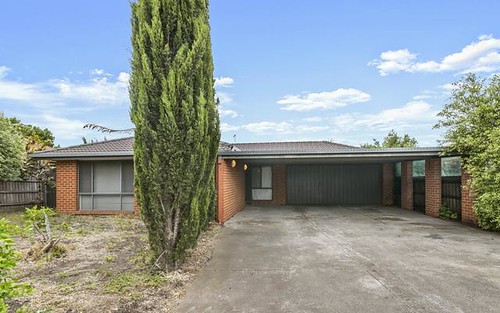
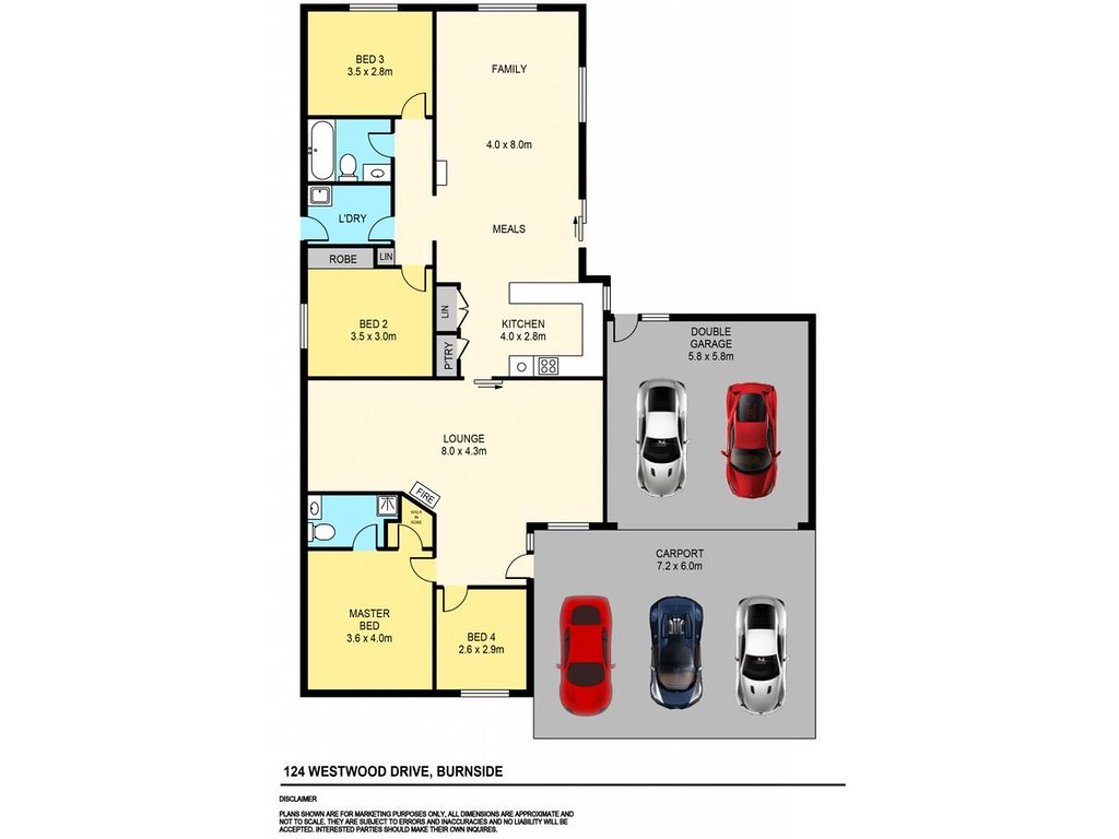
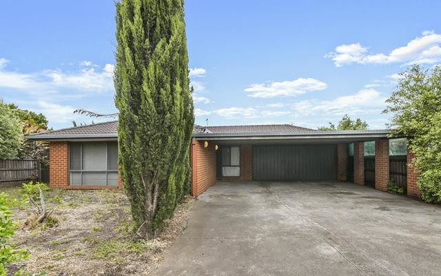
house 3 2 4
$713,000 on 17 Dec 2016 Distance To CBD: 19.16 km
List: $370,000
Land Size: 721 m2
Agency: Barry Plant - Caroline Springs
$440,000 - $549,000Total
$ 39,320
Mortgage registration fee $108
Transfer fee $1,362
Stamp duty on property $37,850
Monthly Repayment
$ 3,062
Total interest payable $531,931
Loan Term 30 years
Annual Interest Rate 5.00%
| Address | Type | Sold Price | ||
|---|---|---|---|---|
| 39 Mockridge Avenue Burnside 3023 | house | 3 | Feb 2024 | $680,000 |
| 16 Fairweather Drive Burnside 3023 | house | 3 | Dec 2023 | $685,000 |
| 17 Kelly Avenue Burnside 3023 | house | 3 | Dec 2023 | $692,000 |
| 9 Huegill Drive Burnside 3023 | house | 3 | Nov 2023 | $585,000 |
| 222 Westwood Drive Burnside 3023 | house | 3 | Nov 2023 | $705,000 |
| 44 Mockridge Avenue Burnside 3023 | house | 3 | Nov 2023 | $557,000 |
| 15 Perkins Grove Burnside 3023 | house | 3 | Sep 2023 | $900,000 |
| 71 Fydler Avenue Burnside 3023 | house | 3 | Aug 2023 | $730,000 |
| Address | Type | Rent Price | ||
|---|---|---|---|---|
| 222 Westwood drive Burnside 3023 | house | 3 | Jan 2024 | $480 p/w |
| 14 Saxby Court Burnside 3023 | house | 3 | Jan 2024 | $450 p/w |
| 32 Milano Road Burnside 3023 | house | 3 | Dec 2023 | $600 p/w |
| 303 Westwood Drive Burnside 3023 | house | 3 | Dec 2023 | $2,167 p/w |
| 16 Moneghetti Place Burnside 3023 | house | 3 | Dec 2023 | $430 p/w |
| 3 Klim Place Burnside 3023 | house | 3 | Aug 2023 | $410 p/w |
| 6 Grigorieva Court Burnside 3023 | house | 3 | Jul 2023 | $400 p/w |
| 2 Jai Court Burnside 3023 | house | 3 | Jul 2023 | $440 p/w |
| Address | Price | Result* | |
|---|---|---|---|
| 22 Tulla Cct | N/A | S | 5 |
| Address | Price | Result* | |
|---|---|---|---|
| 31 Pilbara Av | N/A | W | 6 |
19.67 km to CBD)$797,500
$269,000

 Victoria University Secondary College Deer Park Campus
  St Peter Chanel Primary School Deer Park West Primary School Catholic Regional College Caroline Springs Deer Park North Primary School Christ the Priest Primary School Brookside P-9 College Albanvale Primary School