
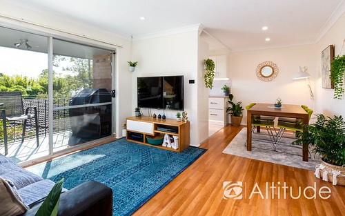
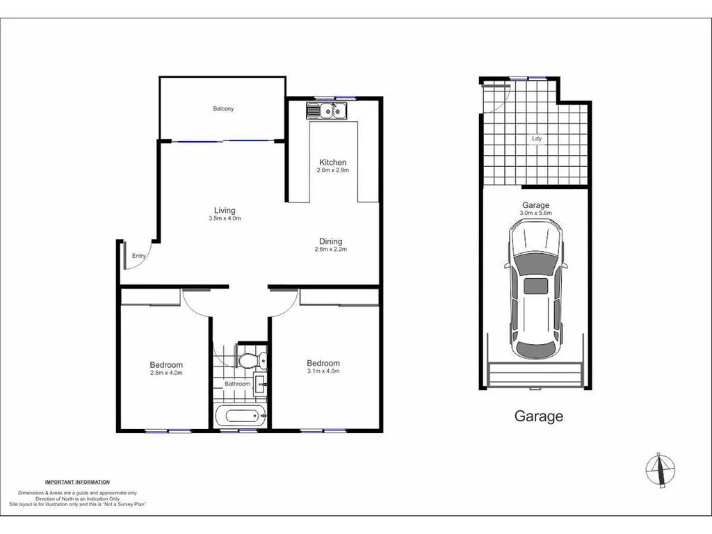
Unit 2 1 1
$410,000 on 26 Jun 2019 Distance To CBD: 114.93 km
Total
$ 14,254
Mortgage registration fee $105
Transfer fee $209
Stamp duty on property $13,940
Monthly Repayment
$ 1,761
Total interest payable $305,879
Loan Term 30 years
Annual Interest Rate 5.00%


| Address | Type | Sold Price | ||
|---|---|---|---|---|
| G02/59 Date Street Adamstown 2289 | unit | 2 | Mar 2024 | $735,000 |
| 205/302 Brunker Road Adamstown 2289 | unit | 2 | Feb 2024 | $693,000 |
| 4/23 Popran Road Adamstown 2289 | unit | 2 | Feb 2024 | $565,000 |
| 3/576 Glebe Road Adamstown 2289 | unit | 2 | Oct 2023 | $506,000 |
| 1/6 Brown Street Adamstown 2289 | unit | 2 | Sep 2023 | $682,000 |
| 2/164 Teralba Road Adamstown 2289 | unit | 2 | Aug 2023 | $637,000 |
| 7/146 Teralba Road Adamstown 2289 | unit | 2 | Aug 2023 | $517,575 |
| 3/195-199 Gosford Road Adamstown 2289 | unit | 2 | Mar 2023 | $535,000 |
| Address | Type | Rent Price | ||
|---|---|---|---|---|
| 7/10 Bourke Street Adamstown 2289 | unit | 2 | Mar 2024 | $420 p/w |
| 4/12 Bourke Street Adamstown 2289 | unit | 2 | Mar 2024 | $460 p/w |
| 13/127 Victoria Street Adamstown 2289 | unit | 2 | Mar 2024 | $420 p/w |
| 2B Yarrum Street Adamstown 2289 | unit | 2 | Mar 2024 | $500 p/w |
| 8/195-199 Gosford Road Adamstown 2289 | unit | 2 | Mar 2024 | $475 p/w |
| 4/627 Glebe Road Adamstown 2289 | unit | 2 | Feb 2024 | $430 p/w |
| 4/25 Popran Road Adamstown 2289 | unit | 2 | Feb 2024 | $490 p/w |
| 1/20 Morgan Street Adamstown 2289 | unit | 2 | Feb 2024 | $530 p/w |
| Address | Price | Result* | |
|---|---|---|---|
| 1/135 Teralba Rd | $820,000 | S | 3 |
| Address | Price | Result* | |
|---|---|---|---|
| 6 Fourth St | $1,600,000 | SP | 4 |
| 4/151 Teralba Rd | N/A | W | 3 |
115.21 km to CBD)$1,057,000
$670,000

 Adamstown Public School St Columba's Primary School
  St Pius X High School Dudley Public School The Junction Public School New Lambton Public School New Lambton South Public School Merewether Heights Public School Kotara School New Lambton Heights Infants School