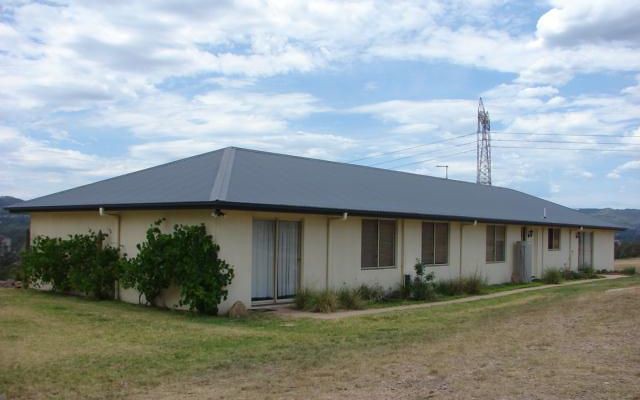
6
Bedrooms2
Bathrooms7
Car Spaces $475,000  Sold on 13 Oct 2018
Distance To CBD: 178.16 km
Agency: Edward Higgens Parkinson First National - Muswellbrook
Total
$ 17,179
Mortgage registration fee $105
Transfer fee $209
Stamp duty on property $16,865
Monthly Repayment
$ 2,040
Total interest payable $354,372
Loan Term 30 years
Annual Interest Rate 5.00%
| Address | Type | Sold Price | ||
|---|---|---|---|---|
| 87A Brook Street Muswellbrook 2333 | house | 6 | Mar 2024 | $510,000 |
| 60 Brentwood Street Muswellbrook 2333 | unitblock | 6 | Dec 2023 | $570,000 |
| 15 Merlot Street Muswellbrook 2333 | house | 6 | Sep 2023 | $660,000 |
| 18A & 18B Dalwood Place Muswellbrook 2333 | house | 6 | Jun 2023 | $590,000 |
| 7 Plashett Close Muswellbrook 2333 | duplex/semi-detached | 6 | Apr 2023 | $760,000 |
| 4 Millard Close Muswellbrook 2333 | house | 6 | Dec 2022 | $558,000 |
| 40 Lexia Street Muswellbrook 2333 | house | 6 | Dec 2022 | $716,000 |
| 39C Rutherford Road Muswellbrook 2333 | house | 6 | Nov 2022 | $600,000 |
| Address | Type | Rent Price | ||
|---|---|---|---|---|
| 9 Doyle Lane Muswellbrook 2333 | house | 6 | Dec 2023 | $660 p/w |
| 9 Manning Street Muswellbrook 2333 | house | 6 | Nov 2023 | $700 p/w |
| 6 Roger Street Muswellbrook 2333 | house | 6 | Dec 2022 | $775 p/w |
| 1 Bimbadeen Drive Muswellbrook 2333 | house | 6 | Mar 2022 | $700 p/w |
| 35 Market Lane Muswellbrook 2333 | house | 6 | Nov 2021 | $400 p/w |
| 4 Roger Street Muswellbrook 2333 | house | 6 | May 2021 | $700 p/w |
| 37 Shiraz Street Muswellbrook 2333 | house | 6 | Sep 2020 | $460 p/w |
| 23 Racecourse Road Muswellbrook 2333 | house | 6 | Nov 2019 | |
| Address | Price | Result* | |
|---|---|---|---|
| 11 Sowerby St | N/A | PI | 4 |
| Rank | Address | Sold Price | Type | |||
|---|---|---|---|---|---|---|
| 1 | 'Bunderra' 267 Grasstree Row Muswellbrook 2333 | $1,900,000 | lifestyle | 5 | 3 | Jan 2024 |
| 2 | 6 Yarraman Road Muswellbrook 2333 | $1,405,000 | mixed farming | 4 | 2 | Feb 2024 |
| 3 | 8 Jackaroo Close Muswellbrook 2333 | $1,037,500 | acreage-semi-rural | 4 | 2 | Nov 2023 |
| 4 | 20 Strathmore Road Muswellbrook 2333 | $1,000,000 | warehouse | 1 | 2 | Dec 2023 |
| 5 | 1 - 2/13 Foley Lane Muswellbrook 2333 | $615,000 | duplex-semi-detached | 4 | 2 | Sep 2023 |
| 6 | 8566 New England Highway Muswellbrook 2333 | $580,000 | acreage-semi-rural | 4 | 2 | Dec 2023 |
| 7 | 60 Brentwood Street Muswellbrook 2333 | $570,000 | unitblock | 6 | 3 | Dec 2023 |
| 8 | 9 Bowman Street Muswellbrook 2333 | $560,000 | unitblock | 4 | 3 | Nov 2023 |
| 9 | 3 Eurabbie Avenue Muswellbrook 2333 | $515,000 | duplex-semi-detached | 4 | 2 | Oct 2023 |
| 10 | 5 Bowfield Place Muswellbrook 2333 | $500,000 | duplex-semi-detached | 4 | 2 | Jul 2023 |
181.49 km to CBD)$425,000
$265,000